|
|
WARNING/DISCLAIMER: Hiking can be dangerous and the information furnished below may contain errors! |
West Mountain Ridge Hike
Total Distance: 4.7 miles
Difficulty: medium (850'+ total elevation gain)
Estimated hiking time: 3 hours
From the parking area (with your back to Seven Lakes Drive) make a
left (to go eastward) onto the 1777W trail (white discs with "77" written in
red on them). In a short while make a right onto the
Appalachian Trail (AT, white blazes) southbound (do not go onto the
combined 1777W / AT trail) and take it until you reach the intersection (on
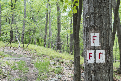
your right) with the Fawn trail (red "F" on white blazes). Take the
Fawn trail until you reach an intersection with the Timp-Torne trail (blue
blazes). Make a left onto the Timp-Torne trail. Take
it (it will combine with the AT for a while) until you reach the West
Mountain shelter. Eat lunch!
Reverse
direction and take the Timp-Torne trail back the way you came. It
will again combine with the AT. When these two trails split, veer
right to stay on the AT and take it until you reach the 1777W trail.
Make a left onto the 1777W and take it back to your car.
REFERENCES: NY-NJTC Map #119 (Northern Harriman Bear Mountain Trails)
Driving Directions from NYC to the Bear Mountain Inn
From NYC take the
George Washington Bridge to the Palisades Interstate Parkway (going
north). Take the Palisades Interstate Parkway north until Exit 19.
Exit at Exit 19. Veer right onto Seven Lakes Drive
(the exit sign on the Palisades may say "Perkins Memorial Drive / Bear
Mountain" but you will in fact be exiting onto Seven Lakes Drive).
Proceed on Seven Lakes Drive about 0.6 miles and turn right onto an
unmarked single lane paved road that leads in a short distance to a parking
area. Park in this parking area (GPS: N 41.30412, W 74.01589).
The total driving distance is estimated at about 41 miles and should
take under one hour without traffic.
Public Transportation
Not available.
Click here for What to Bring on a Hike
Click here for Information for Group Hikes
Questions: Michael Brochstein
 |
|
|
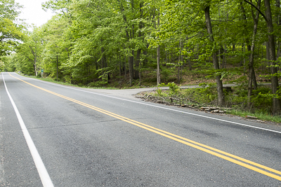
| View from Seven Lakes Drive of the unmarked single lane paved road on the right that leads to the parking area. (May 2015) | The parking area (May 2015) | |
 |
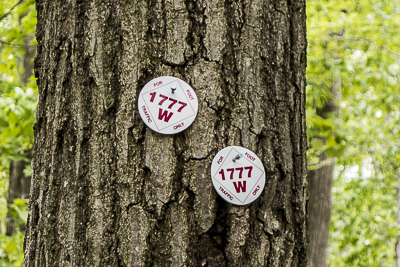 | |
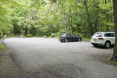
| The hike starts and ends here. Note the very small white disc on the tree on the right marking this trail as the 1777 W trail (May 2015) | Trail markers for the 1777 W trail (May 2015) | |
 |
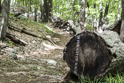 | |
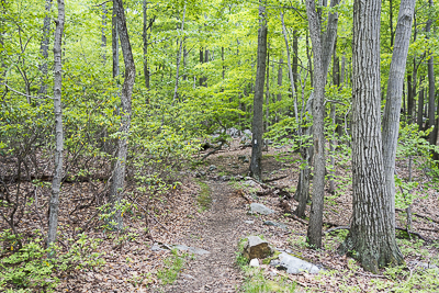
| Along the Appalachian Trail (May 2015) | "In Pursuit of Magic" on the Appalachian trail, written on the log on the right. (May 2015) | |
 |
 | |
| Trail marker for the Fawn trail (May 2015) | Along the Timp-Torne trail (May 2015) | |
 |
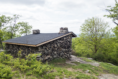 | |
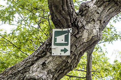
| Marker on the Timp-Torne trail indicating the general direction to the West Mountain Shelter (May 2015) | The West Mountain Shelter (May 2015) | |
 |
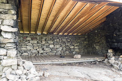 | |
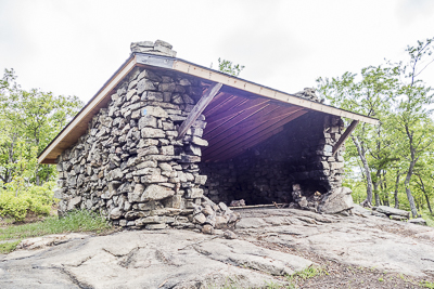
| The West Mountain Shelter (May 2015) | The West Mountain Shelter (May 2015) | |
 |
||
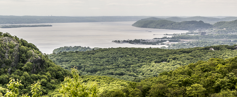
| View of the Hudson River from the West Mountain Shelter (May 2015) | ||
 |
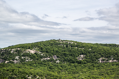 | |
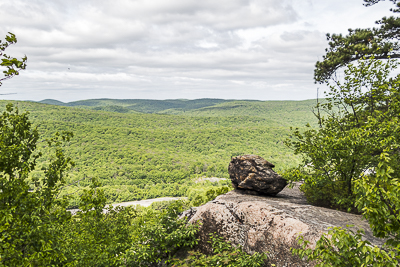
| View (one of many!) from the Timp-Torne trail (May 2015) | Bear Mountain, with Perkins Tower at the top, as seen from the Timp-Torne trail. (May 2015) | |
 |
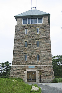 | |
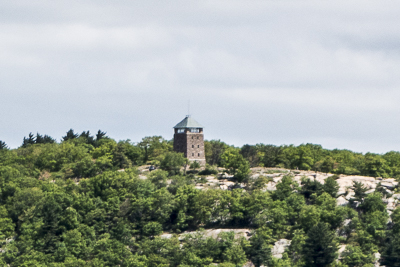
| Close up of the view of Perkins Tower from the Timp-Torne trail (May 2015) | Perkins Tower as seen close up from atop Bear Mountain (July 2006) | |
 |
||
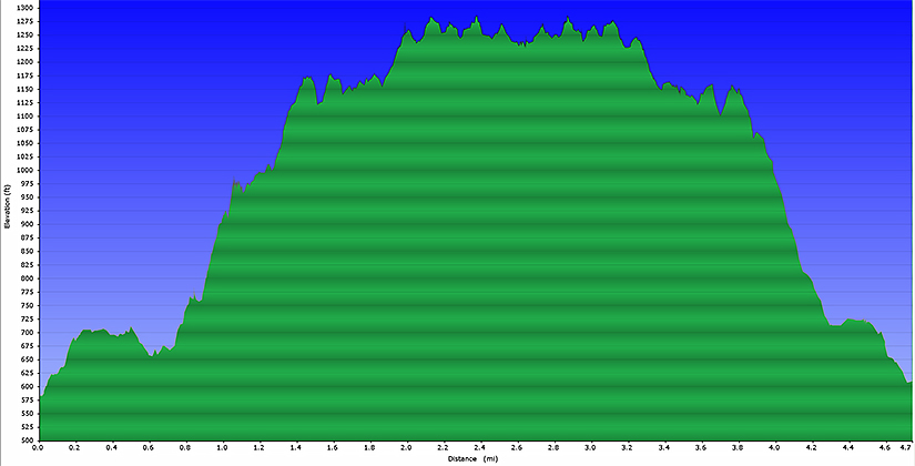
| Elevation profile for hike. | ||
Last updated: 5/2015